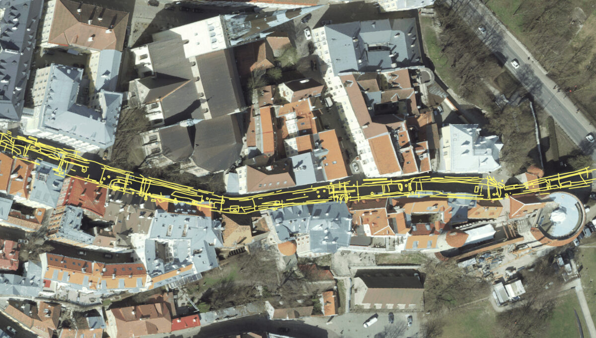
The long street in Tallinn’s Old Town is one of the most important thoroughfares, connecting Suur-Rannavärav with the center of the Old Town. It has many shops, restaurants, and cafés, and thousands of people, both locals and tourists, pass through it every day. As the street pavement is worn out and its visual appearance is poor, the City of Tallinn has decided to renovate Pikk Street. The first stage of the renovation covers the area from Rannavärava Road to Olevimägi.
TASK
In order to prepare a project for the renovation of Pika Street, it is necessary to obtain accurate and reliable data on the existing situation, including what is underground. It is known that there are many different underground utility networks and that there may be remains of walls or other unknown underground objects. The existing geodatabase provides information about which utility networks should be located underground, but the locations and depths indicated in the geodatabase are not reliable. The task of the GPR survey was to identify and accurately map both underground utility networks and all other possible underground objects.
SOLUTION
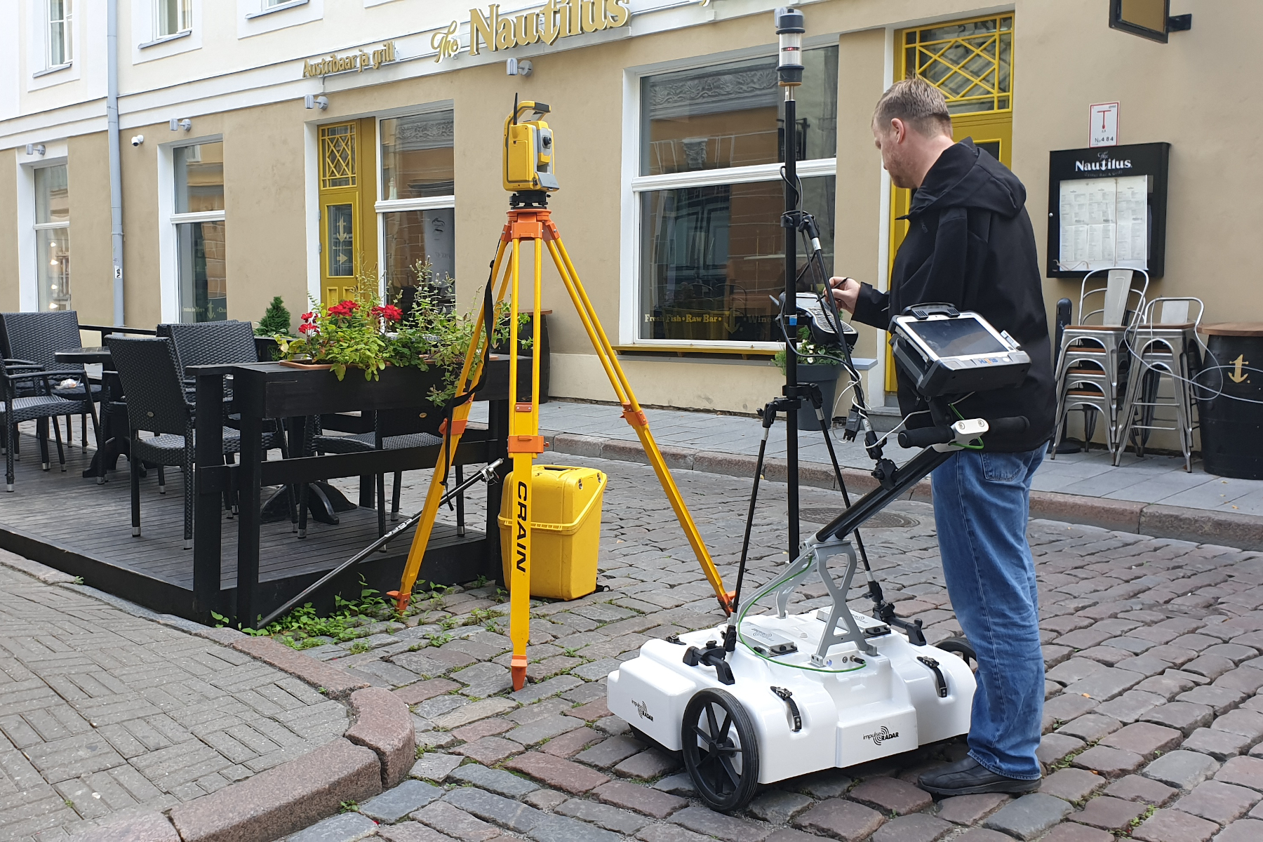
Pikal Street is a busy street. There are always lots of people and cars driving and parking there. Since the task was to identify and accurately map all underground utility networks and other underground objects, the entire ground surface had to be scanned so that no gaps were left. To make this possible, traffic control was ordered from Ramudden OÜ and, with the help of MUPO, all cars were moved for the duration of the scanning. Data was collected using a high-resolution 3D georadar Raptor cart version with a 450 MHz antenna array, with a distance of 8 cm between the antennas, which scans 8 profiles in a single pass. A Trimble S5 total station, ID prism and TSC3 field computer were used for positioning. The positioning data was sent from the field computer as a continuous data stream to the Raptor data collection software Talon, where it was combined with the GPR data.
RESULTS
The entire survey area was scanned in sections so that there were no gaps between the scan lines. A total of 128 survey lines were scanned, resulting in 1024 profiles with 8 cm spacing. The data was post-processed using special software called GPR Slice. This is professional software that allows you to process raw data from virtually all manufacturers of ground-penetrating radars. GPR Slice software is used by many universities and companies conducting geophysical surveys. The purpose of data post-processing was to create visually distinguishable objects from the raw GPR data and then plot and export them in a three-dimensional machine-readable format. The survey identified the exact locations and depths of most of the underground utility networks and also found several other underground objects. The results of the survey will be used in the preparation of the Pikk Street renovation project.


