
The Tallinn Environment and Public Works Department (KKA) is planning to renovate Tina, Vase, and Pika streets. In order to ensure that the construction work proceeds quickly and smoothly and that the excavation work does not cause any accidents, the KKA decided to commission a comprehensive survey of underground utility networks prior to the design phase. The comprehensive survey will identify and map the exact location and depth of all underground utility networks. An important part of the comprehensive survey is a GPR (ground-penetrating radar) survey.
TASK
Identify and map underground utility networks.
SOLUTION
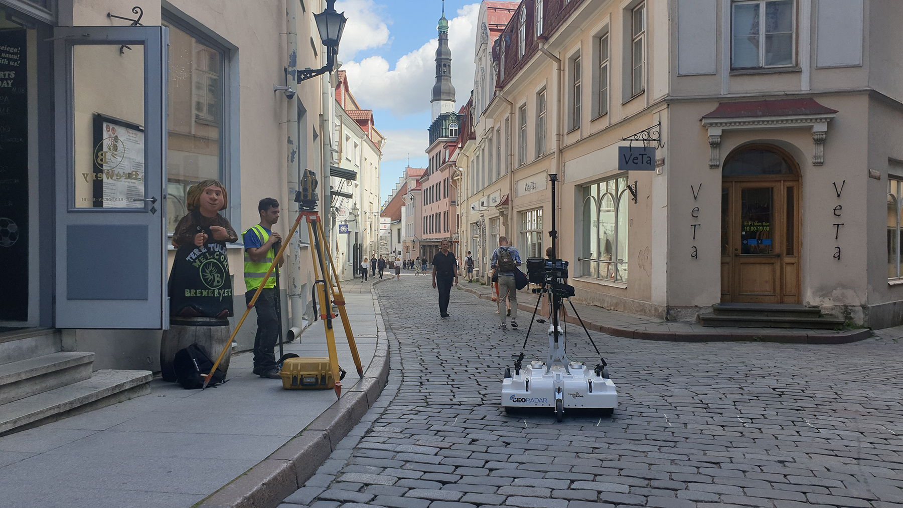
All objects were surveyed using a high-resolution 3D GPR Raptor with an antenna array. A Total Station was used for positioning, which sent positioning data as a continuous data stream to the data collection software Talon, where it was combined with the GPR data. In places that could not be scanned with 3D radar, or where more accurate data was required, additional data acquisition was performed with a single-channel 2D radar PinPointR.
All data collected during fieldwork was processed and the identified utility networks were vectorized using special software GPR Slice. The vectorized objects were exported to CAD and GIS formats for the compilation of a comprehensive complex survey.
RESULTS
As a result of the GPR survey, most of the underground utility networks in all survey areas were identified and mapped. Based on the results of the GPR survey and other data collected, a detailed summary plan of the underground utility networks was compiled, including attribute data. In addition, the results were visualized as a 3D model (see image above).
GPR survey of Pika Street to identify and map utility networks
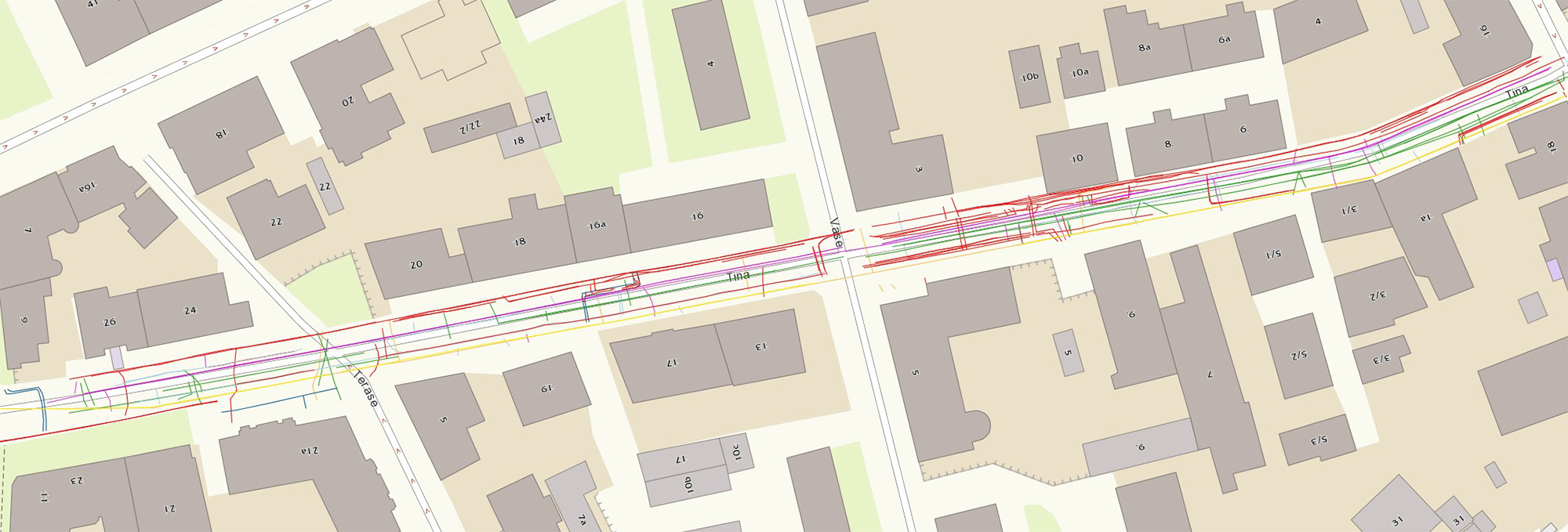
Utility networks identified during ground-penetrating radar survey on Tina Street