
Paljassaare is a peninsula in the northern part of Tallinn, between Paljassaare Bay and Tallinn Bay, in the Paljassaare settlement. The Paljassaare peninsula was formed as a result of human activity. Between 1912 and 1917, the strait between the Tükipealse peninsula and Väike Paljassaare was filled with soil obtained from dredging during the construction of a new military port (Peeter Suure sadam). In 1921, Väike Paljassaare and Suur Paljassaare were connected by a railway embankment. Since the 1950s, Suur Paljassaar has been connected to the mainland, initially by a landfill, then by a military road and later by a sewage treatment plant. The conservation area on the peninsula is a bird sanctuary of European importance, where 229 species of birds have been recorded. The peninsula is largely a wetland covered with dense scrub, reeds and tall grass. (Link to source)
TASK
The water treatment plant of AS Tallinna Vesi is located in the center of Paljasaare. The treated water is directed through three 1200 mm pipes to a slope well in the northern part of the peninsula and from there to Tallinn Bay. The pipes were installed decades ago and are reaching the end of their service life. AS Tallinna Vesi wants to build a new pipeline. To do this, they need to know the exact location and depth of the existing pipeline so that they can design the new one. There is some info about where the old pipeline is, but it’s not reliable because it hasn’t been checked. The purpose of the survey was to randomly check the location and depth of the existing pipeline. The total length of the route was approximately 2.5 km and the area was partly very wet and overgrown. To carry out the survey, suitable locations had to be found for collecting data with a GPR.
SOLUTION
As preliminary information indicated that the pipeline could be located at a considerable depth of 4–5 meters in some places, it was decided to use a low-frequency GPR. The CrossOver730 was selected, which has two frequencies: 70 MHz and 300 MHz. The lower frequency allows for a depth of up to 20 meters, depending on the soil, while the higher frequency allows for a depth of up to 5 meters. The CO730 is a towable radar and can be used to collect data even on very uneven ground. The GPR was dragged perpendicular to the pipeline at pre-selected locations and the center of each pipe was marked. The coordinates of the marked points were recorded with Leica RTK GNSS. In addition, long profiles were scanned perpendicular to all pipes in order to later refine the depth of all pipes during data processing.
RESULTS
A total of nearly 90 points were identified in the survey area. All measured points were entered into QGIS software. The locations of the points were compared with existing information on the location of the pipe network. It turned out that the existing information was largely inaccurate. In some places, the actual location of the pipe was up to 20 meters from where it was known to be. In addition, long profiles were scanned with a GPR at 14 locations. The raw data collected during this process was processed using special software called GPR Slice. GPR Slice is professional software that allows you to process raw data from virtually all manufacturers of ground-penetrating radars. The processed data was used to create radargrams, or vertical cross-sections of the ground. The radargrams show the pipes located in the ground as hyperbolas. The tip of the hyperbola is the top of the pipe, and this was used to determine the depth of the pipe below the ground. Although according to the available information, the pipeline was supposed to be located at a depth of approximately 4–5 meters, the GPR survey did not confirm this. In most places, the pipeline was located at a depth of less than two meters. The deepest point was approximately 3 meters, and in several places, the pipeline was less than 1 meter deep.
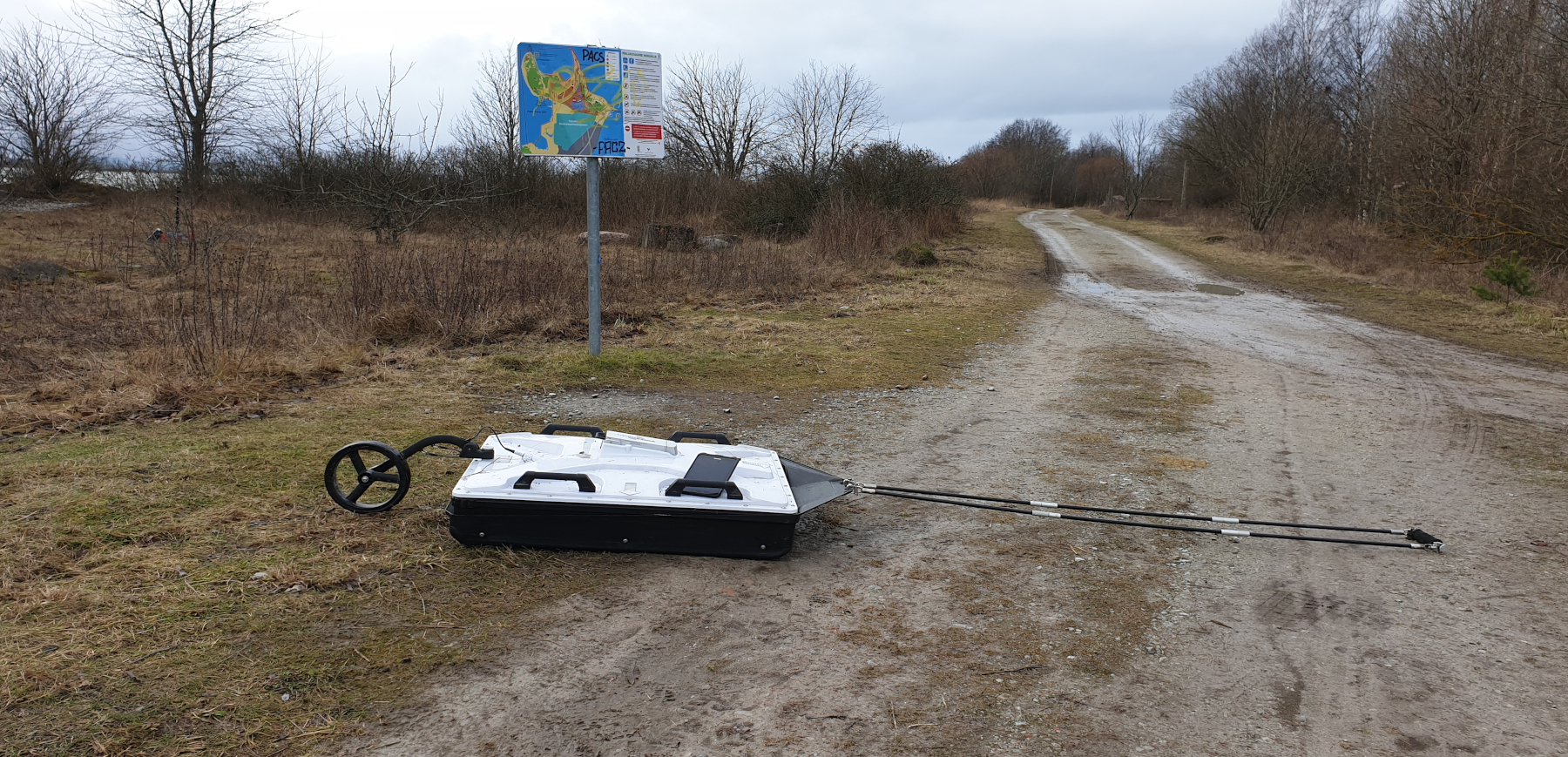
CrossOver CO730 by ImpulseRadar used in the survey
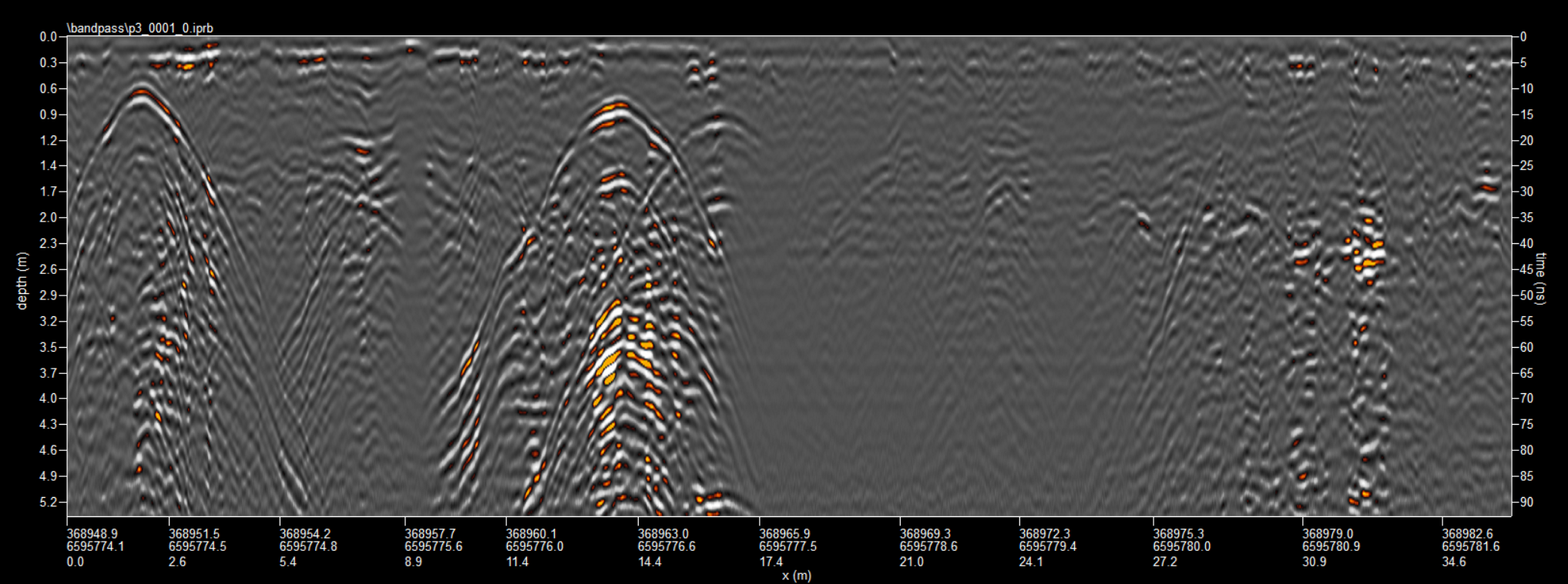
Radar image of the Paljassaare pressure pipeline