
An underground water pipe was damaged on the territory of the Narva power plant. The water that had flowed out of the pipe had partially washed away the soil. The leak had been dug out, but there was a risk that the water that had flowed out could have caused soil erosion further away from the leak.
TASK
To search for possible underground voids around the leak and, if found, determine their exact size and location.
SOLUTION
The survey area was covered with asphalt, so the ground was flat and even. This made it possible to collect data with all GPRs. It was decided to use a high-resolution 3D GPR Raptor with 450 MHz antennas. This solution allows the client to be presented with a visual representation of any underground voids as they are detected. As this was an open area, the GPR was positioned using RTK GNSS equipment.
RESULT
The GPR survey identified one area near the leak where an underground void was likely to exist. No underground voids were found further away from the leak area, so it can be concluded that the leaked water did not cause soil erosion away from the accident site.
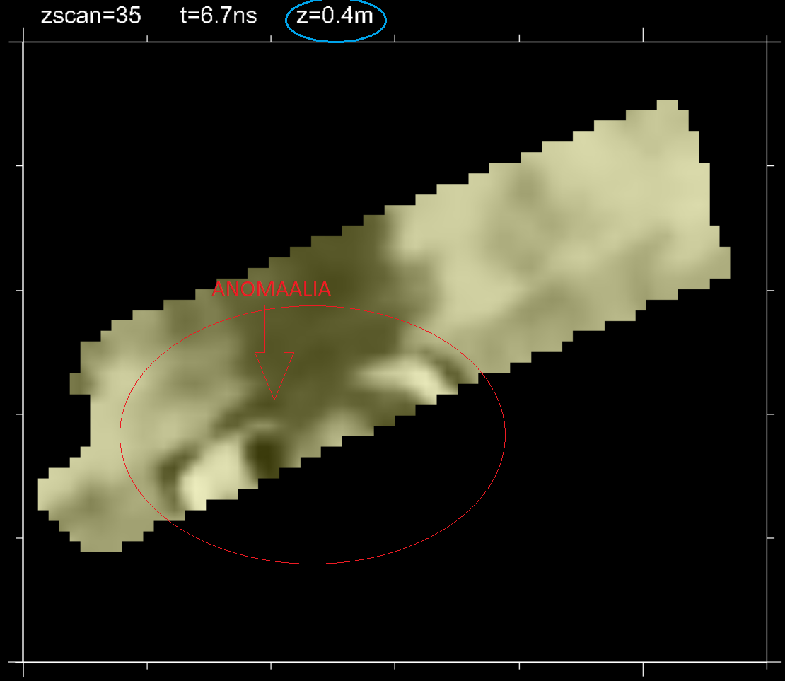
GPR survey on the territory of Narva power plant: anomaly in the survey area