
Historically, the western wall of Narva Castle was surrounded by a moat approximately 30 meters wide. Based on plans from the 1650s, its possible location is known, but its exact extent is unknown. The moat was filled in at the end of the 17th century. It is believed to have been filled with layers of manure alternating with gravel or loose rubble. On top of this is probably a 2-3 m layer of loose demolition rubble. The moat may be up to 10 meters deep. In addition, there were several buildings in the western courtyard of Narva Castle, the ruins of which are believed to be located below ground level.
TASK
The initial task was to identify the historical moat and determine its extent. In addition, the aim was to confirm the location of the ruins of the arsenal building.
SOLUTION
According to preliminary information, the historical moat was approximately 30 meters wide and up to 10 meters deep. Therefore, only low-frequency ground-penetrating radar could be used to map it. It was decided to use a single-channel CrossOver 7030 GPR with two frequencies – 70 MHz and 300 MHz. A lower frequency was used to map the moat. According to preliminary information, the ruins of the arsenal building were not located deep underground, and high resolution was required to accurately identify the walls. For this reason, a high-resolution 3D GPR with 450 MHz antennas was used to map the ruins. As the western moat of Narva Castle is an open area, it was possible to perform positioning there using an RTK GNSS device.
RESULTS
The GPR survey identified the location and approximate depth of the historic moat. The moat was located practically in the same place as indicated by preliminary information, but its maximum depth was only 6 meters. The ruins of the arsenal building were identified and visualized on horizontal cross-sections of the ground surface. The location of the ruins of this building was more or less consistent with the preliminary information about the location of the building.
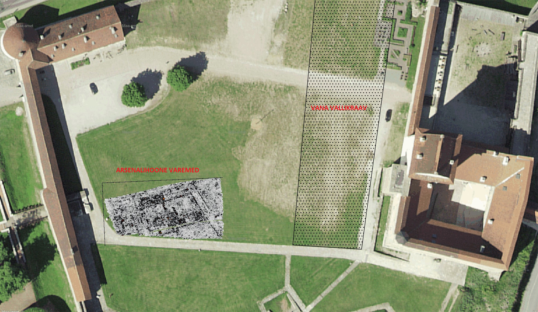
GPR survey of Narva Castle courtyard: historical moat and ruins of arsenal building
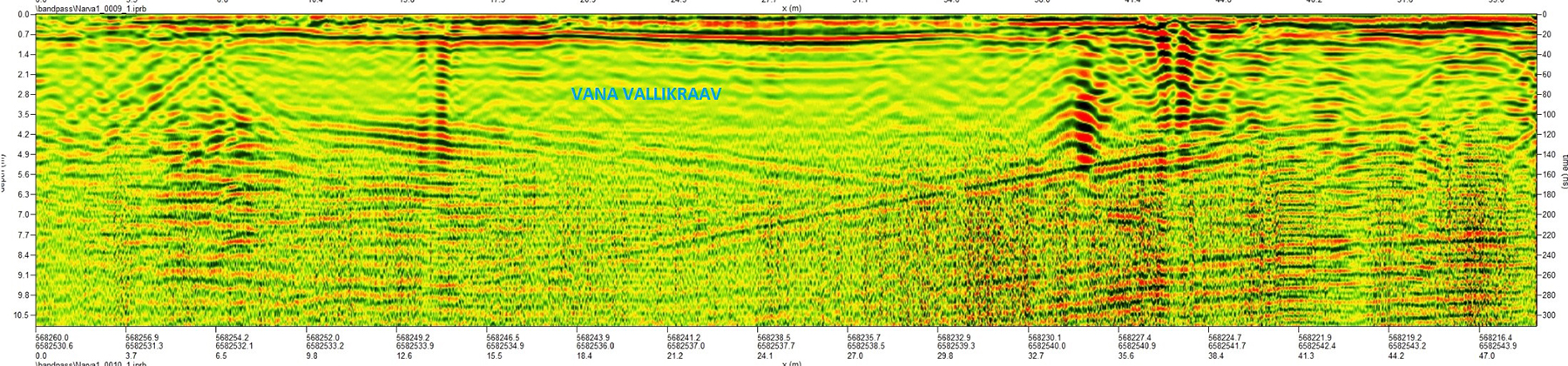
GPR survey of Narva Castle courtyard: historical moat on radar image