
Renovation work has been carried out in front of the D-terminal of the Port of Tallinn, and the square is being completely redesigned. As this is a historic port area, there may be objects of interest to archaeologists. For example, the Tõrvaköögi building was located here in the 19th century. Until the end of the last century, the area was a commercial port with various structures, and there are certainly objects from that period buried in the ground. In addition, there are many different underground utility networks in the area, which must be taken into account during the renovation work.
TASK
The task of the georadar survey was to map underground objects in the area in front of Terminal D of the Port of Tallinn. Special attention had to be paid to the area where the Tõrvaköögi building once stood.
SOLUTION
The task of the survey was to obtain an image of the ground surface with the highest possible resolution. Based on this, a high-resolution 3D radar Raptor was used to collect data. For accurate positioning, the Emlid RTK GNSS device Reach RS2 was used. The permanent network of Hades OÜ was used to obtain corrections. The collected georadar data was processed and visualized with GPR Slice software. The survey area was approximately 1 hectare. As a result, several sub-projects had to be created and data had to be collected and processed in several parts.
RESULTS
As a result of the survey, all underground objects that could be detected by the ground-penetrating radar were mapped. Several objects were located on top of each other, which made it difficult to see the lower objects in some places. Most of the underground utility networks and related structures were mapped. The cables that hold the port quays in place were also mapped. Several underground objects dating back to the commercial port era, such as railways, were also found and mapped. The clear walls and foundations of the tar kiln building had not survived, but anomalies were found in the area that may be the remains of the building.
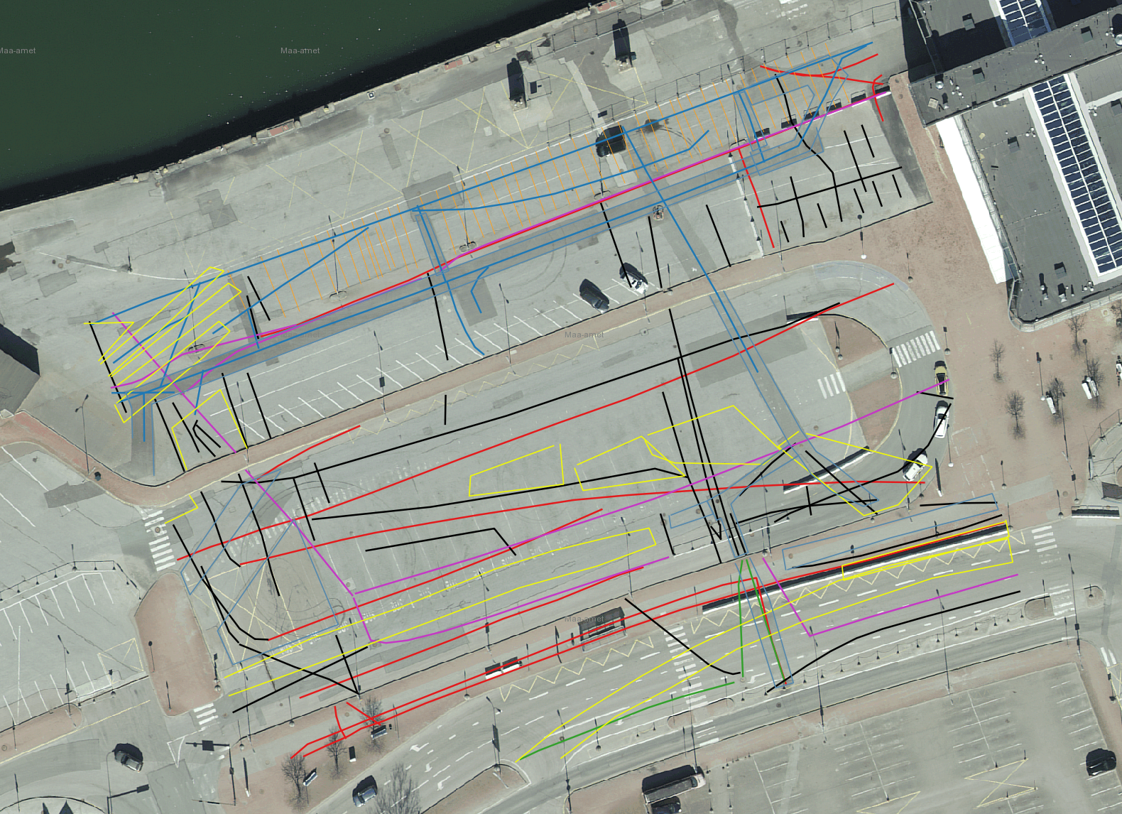
Mapped underground utility networks, objects and anomalies
Underground objects near the quay in a horizontal section video