
Many solar parks have been established in Estonia. Most of them are located on farmland and hayfields. Drainage systems have been built on these lands to drain excess moisture. Most of the drainage systems were built decades ago, and there is no accurate information about their location and depth. Although historical drawings exist, they are generally inaccurate. In order to avoid damaging drainage systems and causing flooding when installing solar panels and cables, the location of drainage pipes must be determined with precision.
Last year, georadar surveys were used to map the drainage systems located within the territory of nearly two dozen solar parks.
TASK
Identify and map underground drainage pipes.
SOLUTION
Solar park areas are generally large and have very uneven terrain. For this reason, scanning the entire survey area with 3D GPR is not a suitable method. Preliminary information was collected on the drainage systems of each solar park prior to fieldwork in order to determine their possible directions and locations. Using the collected data, drainage pipes were identified during fieldwork with 2D GPR and their exact locations were recorded with an RTK GNSS device. The depth of the pipes was determined by processing the collected radar data with special software called GPR Slice.
RESULT
The GPR survey accurately identified and mapped the location of all drainage pipes. All surveys revealed that the existing data on drainage systems is inaccurate and that the drainage pipes are not located where they are shown on historical drawings. The results of the survey, together with a comparison of the existing data, were compiled into CAD and GIS drawings, which were used as the basis for the design of the solar park.
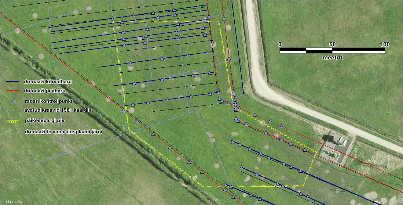
GPR surveys in solar park areas to identify drainage systems
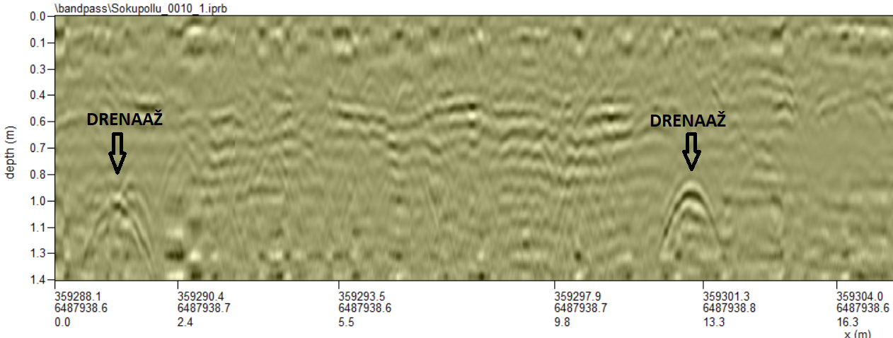
GPR radargram of solar park areas for the detection of drainage systems