
A new burial site needed to be created next to the old graves in Nissi Cemetery. There was conflicting information about the locations of the existing graves. Some of the graves had been covered with a new layer of sand and reshaped. It was possible that the above-ground and underground parts of the graves were no longer aligned.
TASK
Identify the underground parts of the graves and map their exact locations.
SOLUTION
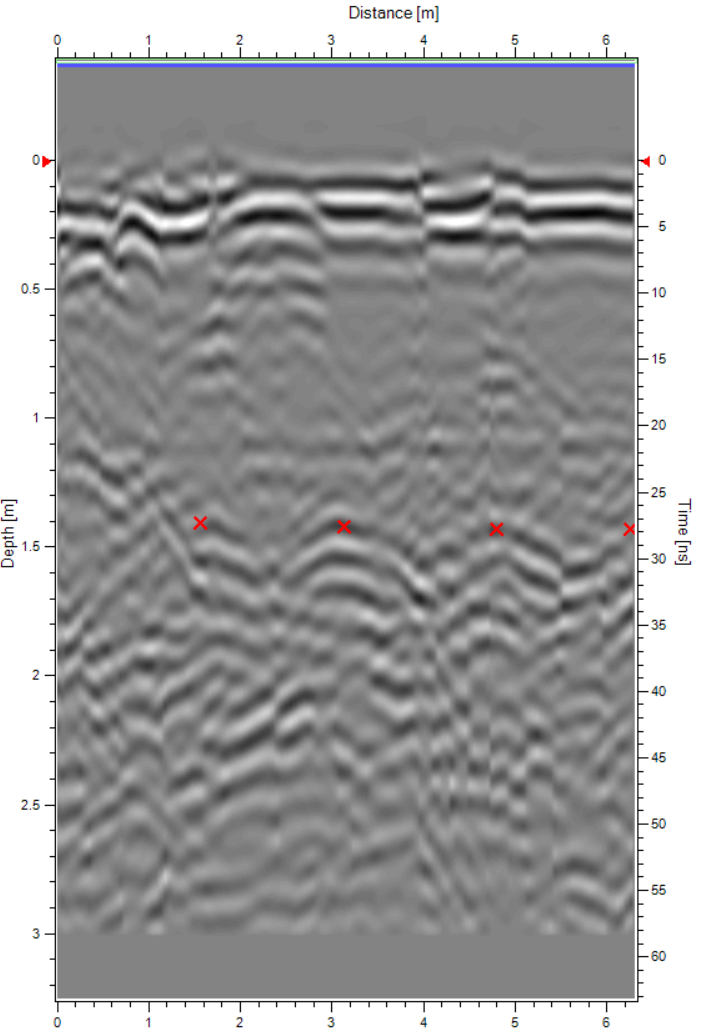
The existing graves had uneven surfaces, with lower edges and higher centers. The graves had to be scanned carefully so as not to damage the grave site. For this reason, data acquisition was performed using a small single-channel 2D GPR PinPointR. For GPR surveys of graves, it is recommended to use an antenna with a frequency of 400 MHz, as this can “see” deep enough and at the same time ensure sufficient resolution. Although PinPointR has two frequencies – 400 MHz and 800 MHz – only the lower frequency was used in this survey.
RESULTS
The survey clearly identified the location of four graves. Their locations were consistent with the statements of the cemetery caretaker. In addition, one very old grave was identified, where the remains had largely decomposed and were barely visible. As a result of the GPR survey, it was possible to determine the location of the new burial site without damaging the existing graves.
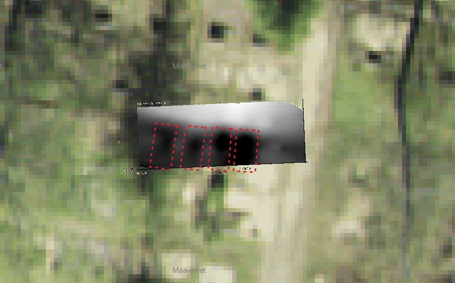
Graves identified by horizontal section of ground-penetrating radar survey
Four old burial sites can be seen on the GPR image.