
The city of Tallinn planned a new tram line from the airport to Vanasadam. This required the construction of a completely new tram track in the center of Tallinn, covering a distance of approximately 2.5 km. The ground in the center of Tallinn is full of various cables, pipes, and other objects. In order to draw up an accurate tram line design and ensure that construction would proceed smoothly, it was necessary to identify and map all underground utility networks and other important underground structures located along the new tram line route.
TASK
Identify and map underground utility networks and other important underground structures.
SOLUTION
As this was a very large GPR survey, which took place partly on roads and partly on sidewalks in the center of Tallinn, it was divided into several projects. Some projects were carried out during the day, while others were carried out at night when there was less traffic.
All projects were carried out using a high-resolution 3D ground-penetrating radar Raptor with an antenna array. A tachymeter was used for positioning, which sent positioning data in a continuous data stream to the data collection software Talon, where it was combined with the GPR data.
All data collected during fieldwork was processed and the identified utility networks were vectorized using special software called GPR Slice. The vectorized objects were exported to CAD and GIS formats for the compilation of a comprehensive complex survey. In addition, horizontal cross-sections of the ground surface were created from parts of the projects to better visualize the underground structures.
RESULTS
As a result of the GPR survey, most of the underground utility networks in all survey areas were identified and mapped. In addition, several underground structures were mapped. The results will be compared with existing information on underground utility networks and objects, and accurate preliminary information will be compiled for the design of the tramway.

GPR survey: utility network routes in horizontal sections
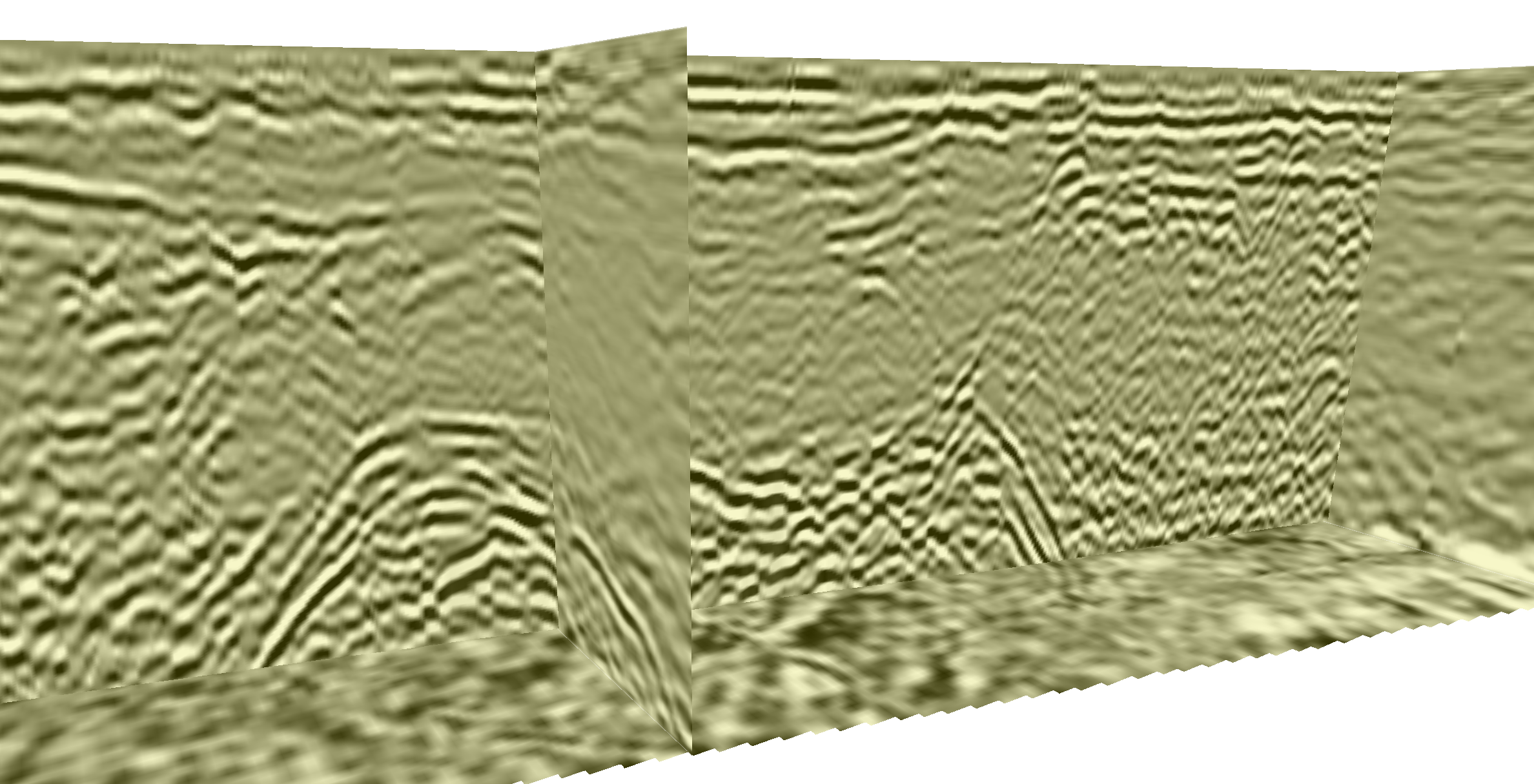
GPR survey: underground objects on radargrams