
The oldest parts of the current Narva Hermann Castle date back to around 1300, when the Danes began building a castle-like fortification to replace the existing wooden fortress. A square tower stood in its north-western corner – the predecessor of the current Long Hermann Tower. The castle has been in the possession of the Danes, Swedes, Russians and the Livonian Order. Over time, various buildings have been erected in the castle – and demolished. As a result, there are many interesting finds hidden in the ground.
TASK
Archaeological research is being carried out in the castle by archaeologists from Tallinn University, part of which involves GPR surveys. The aim of the survey was to map as many underground walls, foundations and other structures as possible. The aim was to obtain the best possible horizontal cross-sections of the ground in the survey area in order to identify the location of historical buildings and structures. The GPR survey was carried out in the western courtyard of the castle, on top of the castle wall at Kristervall and on the southern side of the castle.
SOLUTION
As the task of the survey was to obtain an image of the ground interior with the highest possible resolution, a high-resolution 3D radar called Raptor with 450 MHz antennas was used to collect the data. A Leica RTK GNSS device was used for precise positioning. The EstPos permanent network was used to obtain corrections. The collected GPR data was processed and visualized using GPR Slice software. The data was collected in several parts, as the survey area was large – over 1 hectare. These parts were later combined during data processing to obtain the best possible quality and a complete picture.
RESULTS
The survey revealed many underground walls, foundations, and anomalies – archaeologists can now continue their work with the information collected. This survey is a clear example of how GPR allows for the quick, affordable, and high-quality detection and mapping of underground objects without damaging the ground surface or the object being searched for. To achieve the same level of accuracy without GPR, the entire western wall of Narva Hermann Castle would have had to be excavated to a depth of approximately 2 meters, which would have been expensive, time-consuming, and disruptive to visitors.
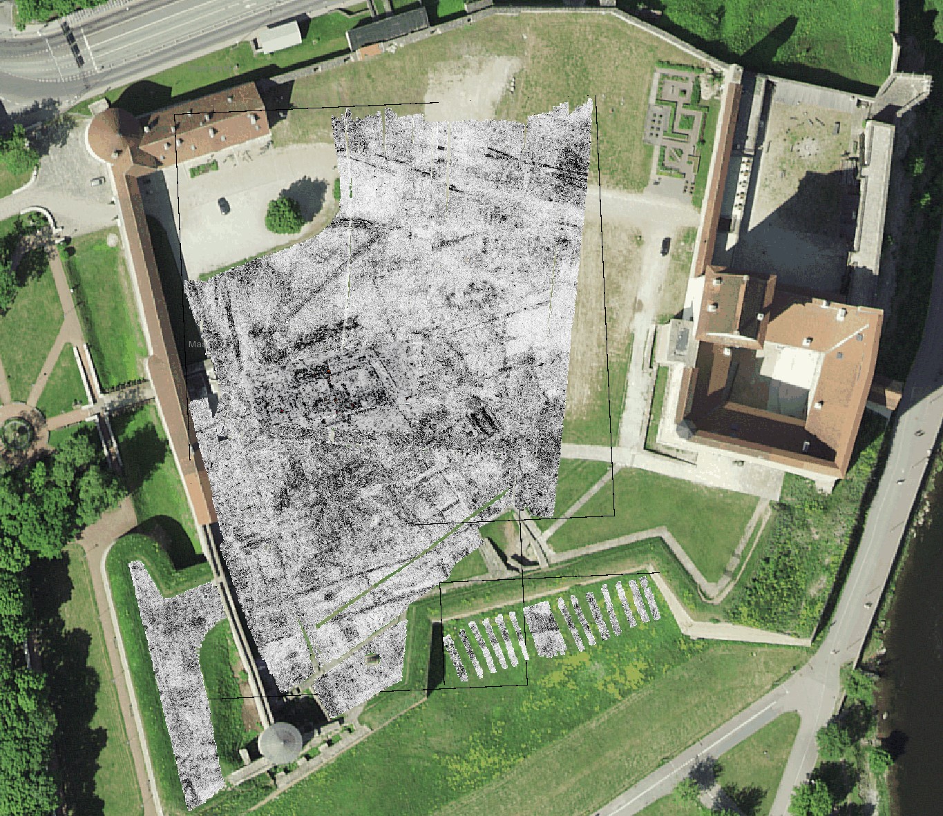
Mapped underground structures in horizontal section of ground surface
Mapped underground structures in a horizontal section video