
There is a large shopping center in the city of Kuopio, at Ratarinteenkatu 2. A large solar park will be built next to it, which will supply the center with affordable and environmentally friendly electricity. The solar park will be built behind the center, partly on a parking lot. According to the drawings, it is known that there are many underground pipes and cables in this area, but their exact locations cannot be certain. The solar park builder wants to mitigate risks and find out the exact locations of the pipes and cables before construction. Breaking an important cable or pipe during construction can mean a very large loss of time and money.
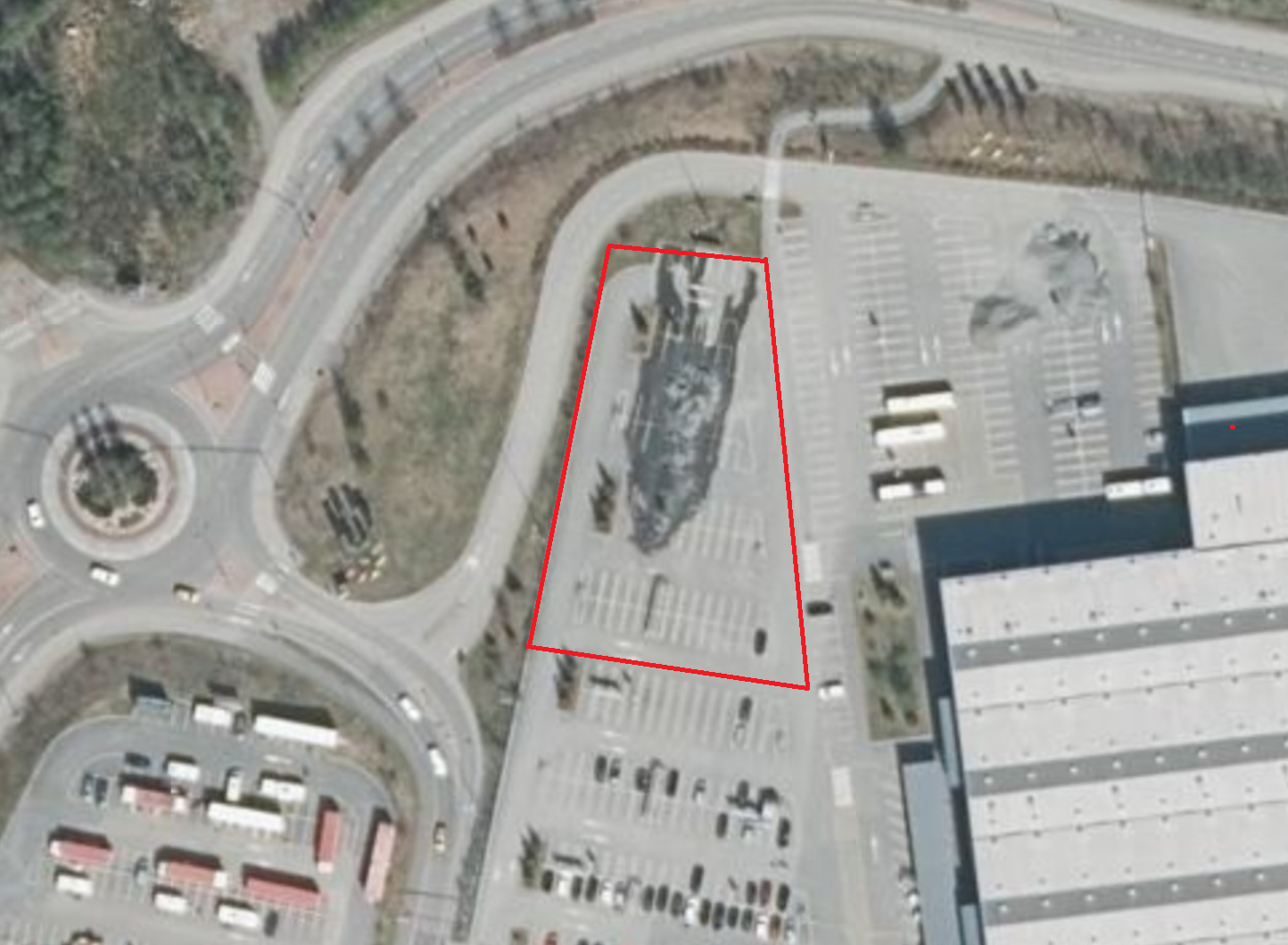 Survey area near Kuopio shopping center
TASK
The purpose of the GPR survey was to accurately map all underground utility networks, which are located up to 2.5 meters below the ground. Since piles are driven into the ground to this depth to build a solar park, the entire area under the solar park had to be surveyed. The client provided preliminary drawings of possible underground pipes and cables.
SOLUTION
The survey area was a large, smooth asphalt parking lot with no obstacles interfering with the scanning of the ground. Since the survey task required obtaining the highest possible resolution image of the interior of the ground, the Swedish company ImpulseRadar’s Raptor high-resolution data array 3D radar was used to collect data. This GPR has eight antennas with a central frequency of 450 MHz. For precise positioning, an Emilid Reach 3 RTK GNSS device was used, for which corrections were received from the Karera OY fixed network. The collected data was processed and visualized with Geolitix software.
RESULT
As a result of the survey, all underground pipes and cables located in the survey area were mapped. The result was formatted as an accurate DWG drawing in the Finnish coordinate system (EUREF-FIN/TM35FIN). In addition, visualized ground penetrating radar data was handed over to the client. As a result of the survey, it turned out that many underground pipes and cables were located in a completely different location from where they should have been located according to the drawings. Without the ground penetrating radar survey, they would most likely have been damaged during construction. Now, however, the builder can change his plans a little and all pipes and cables will remain intact when the solar park is built.
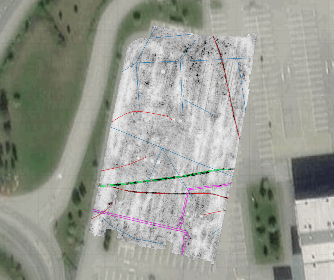 Underground utility networks precisely mapped with ground penetrating radar survey