
In Estonia, Latvia, and Lithuania, drainage systems were mainly established during the Soviet period with the aim of removing excess water from fields and meadows. The authorities are responsible for drainage systems and hold old drawings and diagrams of the systems. Unfortunately, practically none of the old drawings correspond to reality. Old drawings cannot be relied upon, for example, when establishing solar parks or for other purposes where there is a risk of damaging the drainage system during excavation work. A permit from the authorities is required to carry out work in such areas.
TASK
The task of GPR surveying is to accurately map underground drainage systems. Over the years, we have remapped the location of underground drainage pipes across thousands of hectares in the Baltic region.
Thanks to the data obtained from the GPR survey, landowners were able to carry out the desired development work, as the authorities granted permission based on the survey results.
SOLUTION
As drainage pipes are usually located in sections and can run in several directions, cartography was carried out before the field work. Old drawings and diagrams were studied, transferred to modern maps and the possible locations of the pipes were vectorized. The Swedish company ImpulseRadar GPR PinPointR or CrossOver was used for field work. This was used to locate the exact locations of the drainage pipes in the ground. The locations of the pipes detected by GPR were recorded with GPR and an Emlid Reach 2 GNSS device. Official POS permanent networks were used to make corrections.
RESULTS
The GPR survey resulted in the measurement of the locations of the drainage pipes and their approximate depth. The precisely measured pipe locations were imported into GIS software, where a new and accurate drainage system map was created.
In addition, survey reports were prepared for submission to the authorities by the landowners.
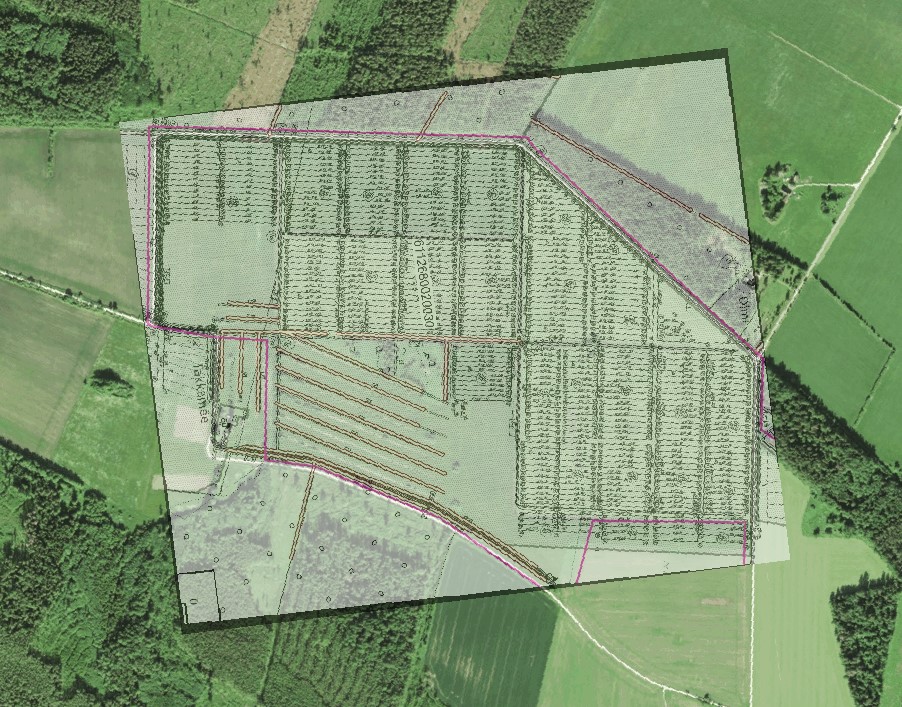
Historical Drainage Map
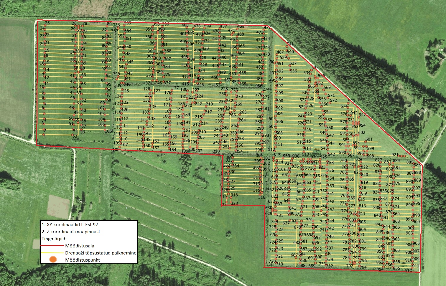
Drainage system mapped with GPR
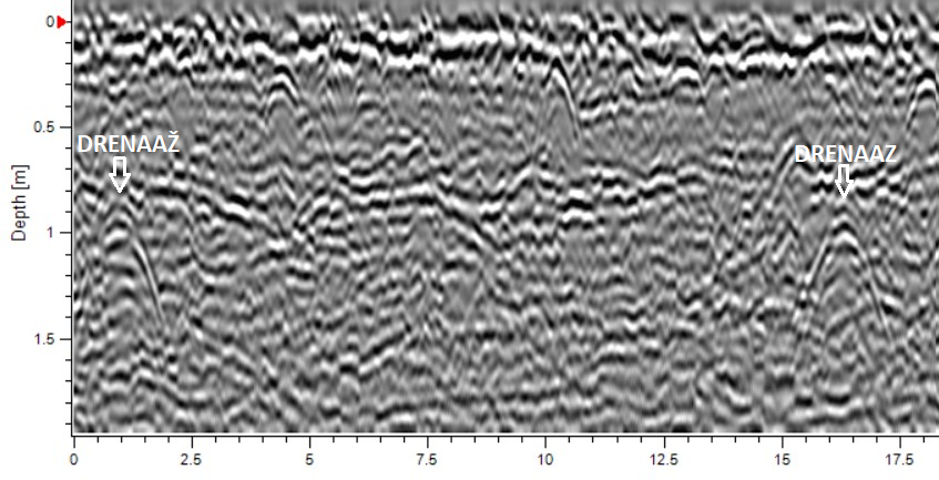
Drainage pipes in vertical section of ground (radargram)